Geography of the Region
The Hranicko region is situated in Central Moravia in the area between Moravská brána (the Moravian Gate) and Podbeskydská pahorkatina (Sub-Beskydy foothills). More than 34.000 inhabitants reside in the region’s 31 municipalities. (Location on map)
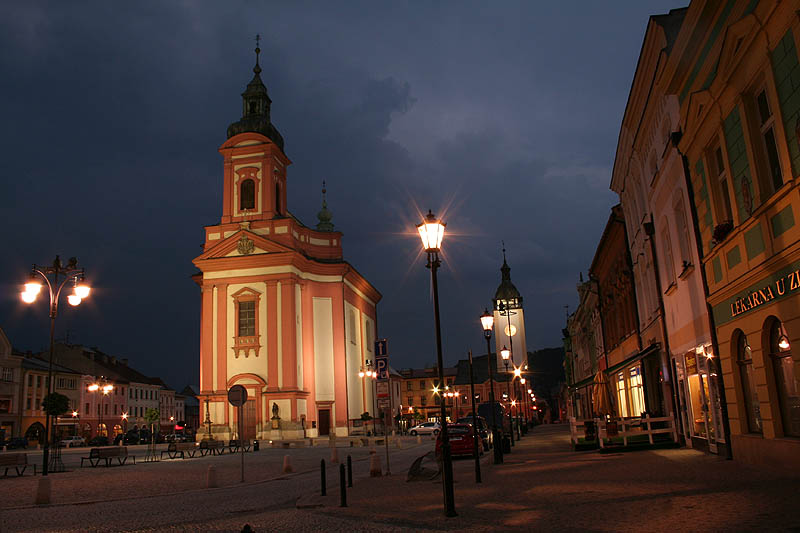
The town of Hranice with 20.000 inhabitants is the region’s centre , and only three other municipalities have more than 1.000 inhabitants. The territory’s elevation above sea level ranges from 250 metres in town Hranice to 502 metres in the Potštát area. Region is well accessible thanks to the position on main international traffic corridors (pan-european railway corridor Prague/Wien – Warsaw, and motorway Olomouc - Ostrava, to be opened in 2008). Europe’s lowest continental divide between the Black and Baltic Sea runs across the region. Its main river Bečva continues to Morava and Danube and forms the East-West axis of the region, while the brooks in the Northern part of the region flow to Odra river. Due to big geological fault running from northwest to southeast there are mineral water springs, caves and deepest abyss in Central Europe in Teplice nad Bečvou.
Local Traditions and Recreation Opportunities
Hranicko Microregion is also known as the green bridge halfway between the Moravian centres of Olomouc and Ostrava. Visitors to the region enjoy nature and landscape ideally suited for hiking, biking and equestrian tourism (network of horse trails is currently under preparation). There is number of interesting natural phenomena, such as 4 national nature reserves, Zbrašov aragonite caves, Potštát rock city, nice woods, hills and lakes.
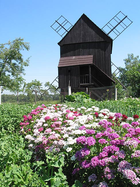
The range of local historic, cultural and technical monuments is even broader – urban monument zones in Hranice and Potštát, castles in Hranice, Hustopeče, Potštát and Všechovice, windmills in Skalička and Partutovice, the spas in Teplice nad Bečvou or hunting lodge of Kunzov. Life in small villages is rich with traditional local customs (“bear walking” carnival, maypole festival) and activities of local citizen groups (sportsmen, fire brigades, hobby gardeners, anglers, hunters, musicians) and schools. All these groups are very active in the cultural and social life of the region. There is a number of important and interesting cultural events, such as Hranice Rock Fest, Hustopeče Days, Microregion Záhoran Olympic Games or Hranice Culture Summer. Sports and recreation facilities of the region include indoor swimming pool in Hranice, golf course in Radíkov, petanque field in Valšovice, ski slopes in Potštát and Partutovice, flying club in Drahotuše, number of tennis courts, beach volleyball and football fields. The whole region is equipped with a dense network of bike trails. A theme bike trail connecting three circular routs presents the history of local wind and water mills.
Regional development
Rozvojová strategie regionu Hranicko (Hranicko Region Development Strategy), where the main priorities of the region are described, was updated in 2006 and focuses on the following areas: development of tourism and expansion of the offer, improvement of roads and transportation services, building of water management infrastructure, support of development of business activities, social and health services, information and education system, nature and landscape maintenance and management, energy resources. Aside from the individual municipalities and few private sources, several organizations strive to implement the strategy.
Document in Czech language:
Strategie rozvoje regionu Hranicko [280 kB]